




MIND THE BRIDGE project is over
The MIND THE BRIDGE research and development project has come to an end. The project focused on designing and testing new solutions for the continuous monitoring of the stability and safety of strategic infrastructure such as bridges and viaducts.
Lasting 18 months and co-financed through the ERDF Regional Programme Liguria 2021–2027, the project brought together companies and research organisations from the Ligurian region, combining expertise in structural monitoring, IoT sensors, geomatics, territorial analysis and digital platform development.
The initiative addressed the need for more effective, timely and integrated infrastructure monitoring. Bridges and viaducts are essential to mobility and territorial connectivity, but are also complex structures exposed over time to mechanical stress, environmental changes, deterioration and potential risks related to their surrounding areas.
Against this background, MIND THE BRIDGE developed and tested an innovative approach based on integrating different monitoring technologies within a single digital ecosystem.
An integrated approach to infrastructure monitoring
One of the main outcomes of the project was the development of an integrated prototype system for the acquisition, transmission, management and continuous analysis of data from different types of sensors.
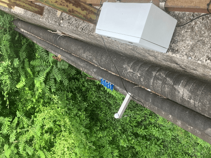
The solution combines sensors installed directly on the infrastructure, devices for displacement monitoring, low-power IoT networks and tools for observing environmental and territorial phenomena. The collected data are transmitted to a centralised platform, where they can be stored, processed, compared and visualised.
This approach overcomes the fragmentation often found in traditional monitoring systems, where structural, environmental and territorial data are managed through separate tools and uncoordinated procedures.
MIND THE BRIDGE instead aimed to create a unified information framework capable of representing not only the behaviour of the structure itself, but also the context in which it is located. The condition of a bridge or viaduct can be influenced by numerous factors, including extreme weather events, temperature variations, slope instability, landslides, hydrogeological hazards and gradual changes in ground conditions.
Integrating these different sources of information makes it possible to better interpret detected anomalies and identify potential correlations between infrastructure behaviour and phenomena affecting the surrounding territory.
A cloud platform for information management
Data collected by the different monitoring systems are sent to a dedicated cloud platform designed to centralise information and make it available to authorised users. The platform acts as a link between field devices and the tools used by technicians for analysis.
Centralising information offers several advantages: it prevents data from being scattered across separate repositories, facilitates comparison between different sources and provides an up-to-date overview of the infrastructure’s condition.
Looking ahead, such a platform can also support the definition of alert thresholds and automated notification procedures, enabling anomalous variations or conditions requiring further investigation to be identified promptly.
The Digital Twin of the infrastructure
Another key element of the project is the use of the Digital Twin of the infrastructure. The Digital Twin is not simply a three-dimensional representation of the bridge or viaduct, but an information environment in which the geometric model can be connected to sensor data and other available information about the structure.
This integration makes it possible to associate measurements with the physical locations where devices are installed, facilitating the understanding of the spatial distribution of observed phenomena. Technicians can quickly identify the location of a sensor, check which parameters are being monitored and analyse the evolution of the corresponding measurements.
The Digital Twin also provides an intuitive way to represent the relationship between the infrastructure and its surrounding territory. This is particularly important where the stability of the structure may be affected by slopes, waterways, geological conditions or other environmental factors.
The combination of the digital model, georeferenced data and time series therefore provides a valuable tool both for technical analysis and for communicating information among the different stakeholders involved in infrastructure management.
Gter’s contribution
Within MIND THE BRIDGE, Gter contributed to the monitoring activities by integrating its DISPLAYCE solution, developed for continuous displacement monitoring using GNSS technologies.
GNSS devices installed at key points of the infrastructure make it possible to determine their position over time and detect any movements. By processing satellite observations, displacement time series can be generated and the different components of movement analysed separately.
GNSS offers the advantage of enabling continuous and automated monitoring of points that may also be located at a distance, reducing the need for frequent manual measurement campaigns. Data can be regularly acquired, transmitted to the platform and analysed together with information from other sensors.
During the project, Gter worked on integrating the information generated by DISPLAYCE into the overall MIND THE BRIDGE architecture. Displacement time series can therefore be accessed through the shared platform and compared with structural, environmental and territorial data.
The added value lies not only in the accuracy of each individual technology, but in the ability to combine different sources of information. For example, a variation detected through GNSS can be analysed alongside weather conditions, measurements from other sensors and territorial data, supporting a more comprehensive assessment of the observed phenomenon.
Future perspectives
The conclusion of the project is not an endpoint, but a starting point for further developments and applications.
The architecture developed through MIND THE BRIDGE can be further refined and adapted to different types of bridges, viaducts and infrastructure. New sensors, automated analysis models and algorithms capable of detecting anomalous behaviour or supporting the prediction of how phenomena may evolve could also be integrated.
Future developments may include enhanced alert systems, integration with the operational procedures of infrastructure managers, and connections with other territorial and infrastructure databases.
The approach tested has potential applications not only for road and motorway network operators, but also for local authorities, public administrations, civil protection organisations and entities responsible for territorial safety and maintenance.
MIND THE BRIDGE has therefore laid the foundations for a more continuous, multidisciplinary and informed monitoring model, in which field data are transformed into information that can support decision-making.
The collaboration between companies, technical experts and the research community brought together different areas of expertise around a common goal: to develop innovative tools for better understanding infrastructure, preventing risks and contributing to the safety of both the territory and its people.
